
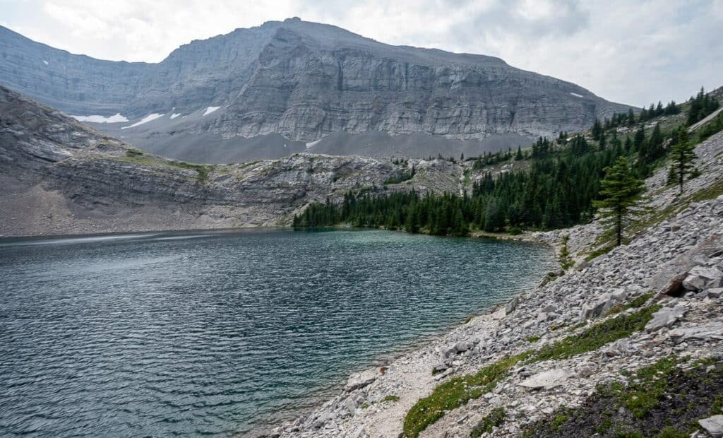
Over the last few years I’ve heard a lot about Carnarvon Lake in Kananaskis Country. Some have called it the most beautiful lake in Kananaskis, but I think there are others that could vie for that accolade. It’s certainly a pretty lake, with an interesting approach that adds to the allure, as not every hiker will be comfortable getting up to it.
The 10.2 km hike up to Carnarvon Lake in Kananaskis Country is 95% easy and 5% very difficult thanks to a headwall section with chains. In my opinion, and because we did it, I wouldn’t recommend taking your dog, especially if its a big dog. And avoid the hike on a rainy day as the rock would be more slippery than usual.
For the best view of Carnarvon Lake, hike 10 – 15 minutes above the lake. From there you’ll get the famous views you see on Instagram. We did not hike up above the lake in the interests of time because we did it as a long day hike. But if you’re biking part way to the lake, or camping, be sure to leave your tent so you can take advantage of what is truly a breathtaking view.
For experienced hikers another amazing two to three day backpacking trip in Kananaskis Country is the Northover Ridge Traverse with a night at the Aster Lake and Three Isle Lake campgrounds.
This post includes some affiliate links. If you make a qualifying purchase through one of these links, I will receive a small percentage of the sale at no extra cost to you. Thank you very much for your support.
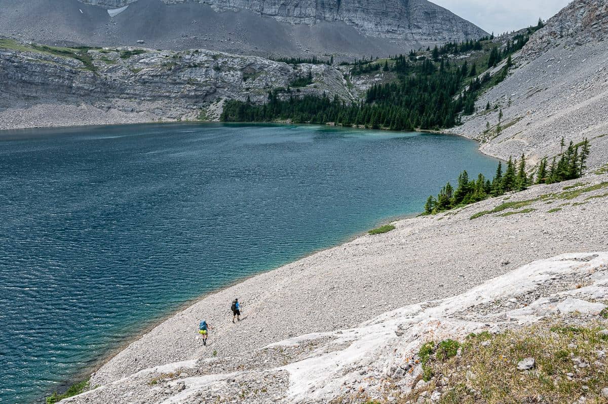
 Note the trail near the edge of Carnarvon Lake
Carnarvon Lake hike summary
Distance: 20.4 km or 12.7 miles
Elevation gain: 857 m or 2,812 feet.
Time needed: 6 – 7 hours with time for breaks, the river crossing and almost an hour at Carnarvon Lake.
Level of difficulty: Easy until the chain section which will be challenging for many – especially when carrying a pack and when it’s wet.
Permits: Purchase a Kananaskis Conservation Pass online. You can purchase a daily or yearly pass. There is no cell service at the Cat Creek Recreation Area, so purchase before you lose cell service or risk a $150 fine.
Dogs: Permitted on a leash but wouldn’t recommend on the chains. The larger the dog the harder they will be to manage.
Bears: Take easy to access bear spray that hasn’t expired.
Horses: You might see horses on the trail. Be prepared to pull over quickly whether on a bike or on foot.
Bikes: Mountain biking is a great option to do part of the trail but wait until the Highwood River level has dropped or it may be a struggle to get across. You can stash bikes in the trees before you get into the heavy scree, somewhere around the 7 – 8 km mark.
Map: Gem Trek Highwood & Cataract Creek. I’d also suggest Organic Maps, a free offline hiking app.
Don’t forget: Pack the hiking essentials. Take lots of high calorie snacks if you’re doing the hike in a day. Always let someone know where you are going. I’d suggest carrying a Garmin inReach Mini 2.
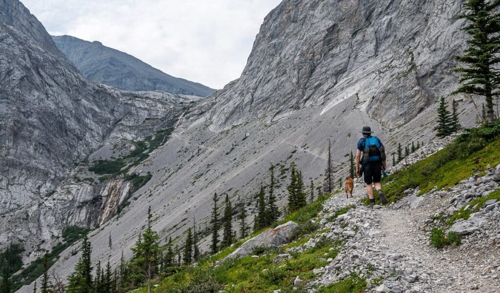 Easy walking on scree to the chains section
Obstacles on the hike to Carnarvon Lake
There are two major obstacles on the hike to Carnarvon Lake that could force you to turn back – high river levels 2.6 km into the hike – and the chain section just before reaching the lake.
Highwood River crossing
The water levels on the Highwood River can vary considerably in one day. The Highwood River is a tributary of the Bow River. With snow melt you can expect more water on the Bow and hence the Highwood too. We noticed that the same spot on the Highwood River was several inches higher later on a sunny afternoon than it was at 10 AM in the morning.
If it’s too deep or running hard, either turn back or look for a shallower place to cross. It’s bloody cold too!
Recommended reading: 12 Safety Tips for Crossing Rivers & Streams
The chains section
The chain section was longer than I expected. The first chain section was fine with lots of good footholds and handholds. Then there is a narrow walk around some rock to pick up the next chain section. This was considerably harder (especially with a dog) because the rock has been worn smooth. The last chain section is not difficult.
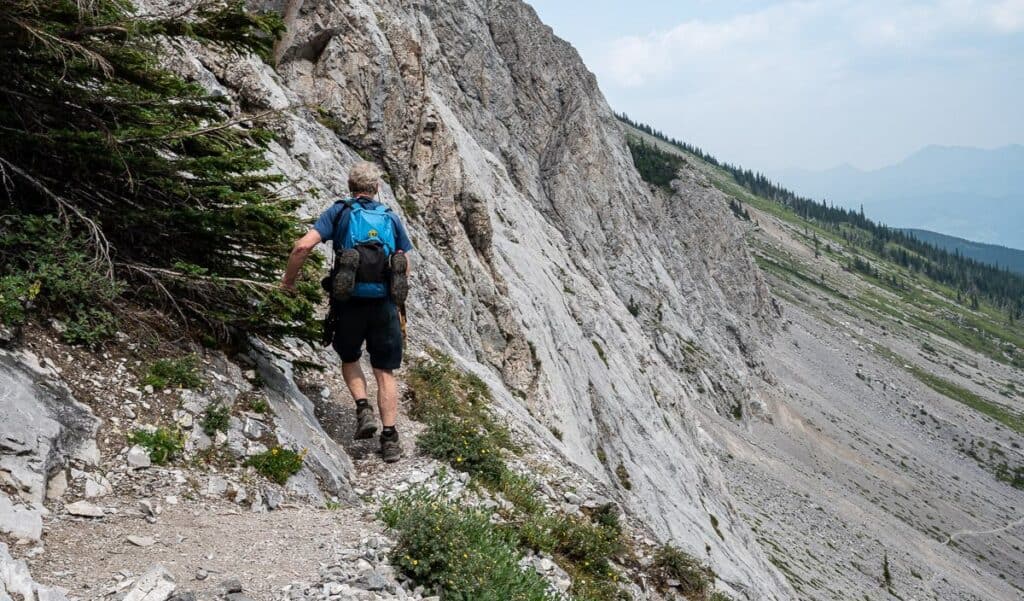 On a short airy trail to the next section of chains
Finding the trailhead
Park at the Cat Creek Recreation area off Highway 40. Make sure you’ve got your Kananaskis Conservation pass before you leave home as there is no cell service to purchase it once on Highway 40.
There is no signage whatsoever, but if you walk past the barricade by the tree with rocks (see picture below) you’ll be on the right trail to Carnarvon Lake. You should pass a bench within about 30 seconds.
 The parking lot at the Cat Creek Recreation Area; the trail starts over by the rocks and posts
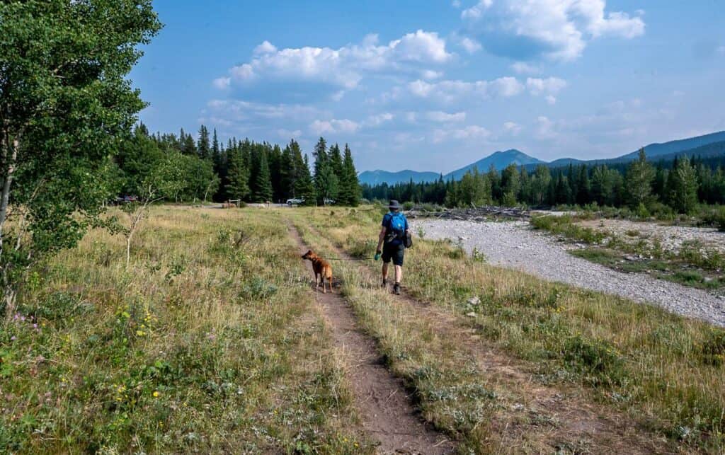 The view of the parking lot at the end of the Carnarvon Lake hike
Hike description
The first 2.6 km on the hike to Carnarvon Lake goes quickly. It’s generally flat and surprisingly scenic with lots of wildflowers, views of the Highwood River and the distant mountains.
When you reach Highwood River, change into your water shoes, pull out your hiking poles, and undo the straps on your backpack. It’s not a long wade across, but it’s cold, footing is uneven, and the water might be moving at a good clip.
Keep your water shoes on until the next water crossing, about 400 m away. You’ll pass a couple of turnoffs to reach it. Stay left.
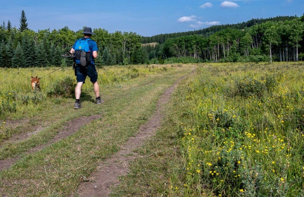
After the quick second crossing, you’re into the trees for the next 6 km or so. This is where you’ll be thankful if you have a bike, especially on the way back. There are some peek a boo views in the trees and lots of Indian paintbrush and other wildflowers in places.
Pass a turnoff on your left (it’s not that obvious) about 2 km after crossing the last stream. That trail heads southeast towards the Strawberry Hills, but you’ll want to go straight. It’s at this point that the trail narrows, and the grade steepens. Some of this area is wet and it looks like it was recently very muddy.
In the wet areas, we ran into a lot of annoying biting flies. That made us quicken our pace even more.
After you pass a boundary marking the wildland provincial park you’ll notice a couple of primitive campsites some distance apart. Soon you can see the trail up ahead in the scree, but you can also see the trail continuing to climb through the trees.
In short order, you’ll pass the trees and get onto a scree trail that’s got ball-bearing size rocks at first followed by good scree all the way across to the waterfall.
Don’t cross the outlet stream at the bottom of the initial drop of the waterfall. Instead climb up right of the waterfall on a very short section with the help of tree branches. You’ll see the chains at that point.
If you’re carrying a backpack, especially a heavy one, this can be a tricky section. Put away your poles as they would just get in the way. Also, make sure you always have three points of contact as you climb up – two hands and a foot or two feet and a hand hold on.
The first section of chains seemed easy because of all the hand and footholds. At the top of this you walk on a narrow trail to the right around a corner to an area with a large overhang where people can hang out and wait for those going up or down. (Never rush someone!)
The next section of chain was the most challenging as the rock is very smooth in places. I found it easier to go out to the right where I found more hand and toe holds.
When you reach the top of the final chain section, which has loads of places for feet and hands, you are home free. It’s a short walk on more scree to reach Carnarvon Lake. Around the outlet area at the top, it was very windy, and the temperature was quite a bit cooler.
Follow the trail on the right around Carnarvon Lake towards the trees if you’re planning to camp – or even if you’re not as it’s worth the short hike to get the view down the lake. You’ll find the wind dies down quickly in the trees too.
You can walk through the camping area and look for another trail climbing higher. Follow it for 10- 15 minutes to get a panoramic view of the lake surrounded by mountains, almost on the Alberta – BC border.
Enjoy your lunch, time spent fishing (a popular activity at the lake) or a night or two. Retrace your steps to return to the parking lot. We were back in 3.5 hours – which included a wait for people coming up and going down – and taking our time with our dog on the descent.
Carnarvon Lake hike photos
The photos of the Carnarvon Lake hike are in chronological order.
 The first 2.6 km is flat easy walking with lots of wildflowers in late July
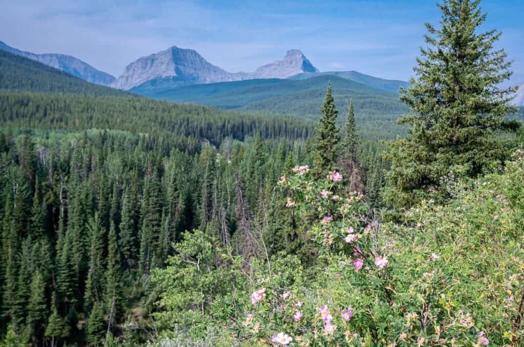 Distant views of where we’re heading – between the two far left peaks
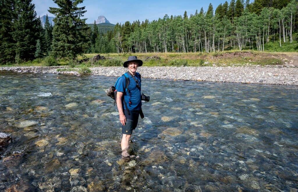 Don’t forget the water shoes for the Highwood River crossing
 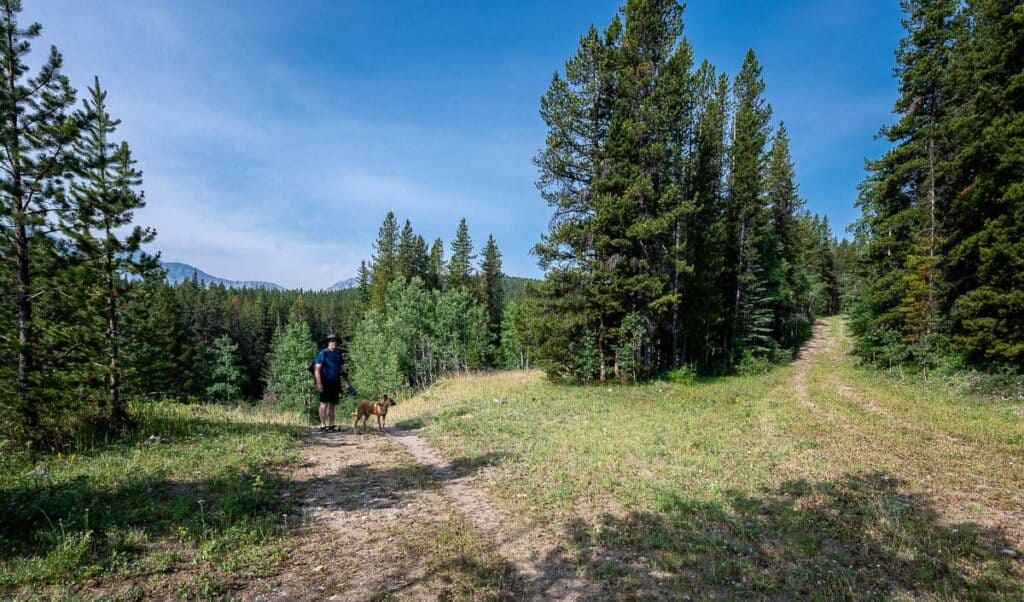 Stay left at the first junction; we still had our water shoes on as there is one more easy crossing coming up
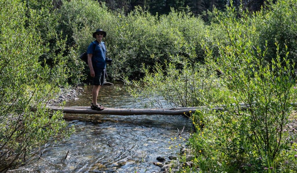 Wade or walk the logs across McPhail Creek
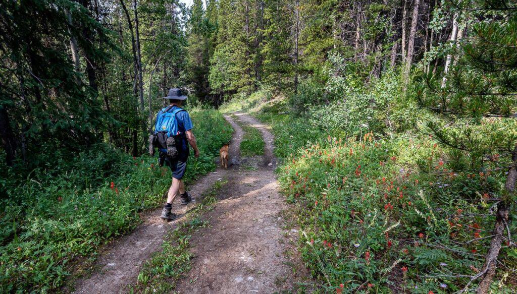 Walk an old road towards Carnarvon Lake lined with wildflowers, shrubs and trees
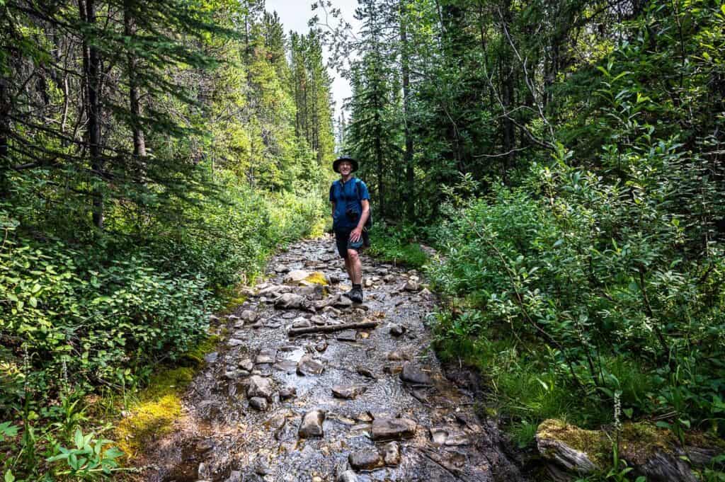 There are some wet sections our dog loved
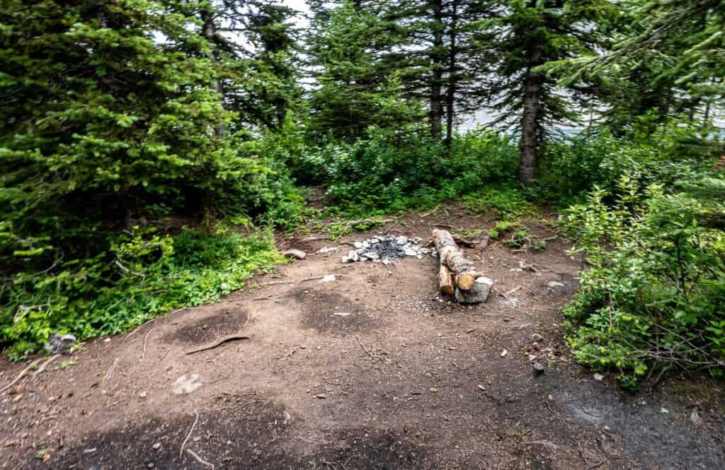
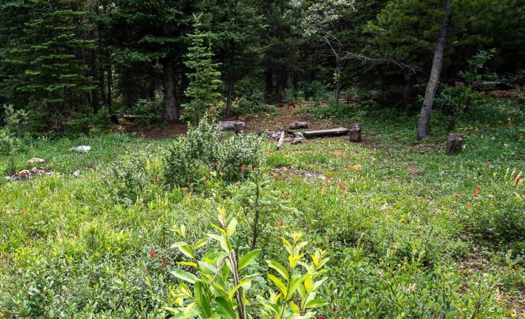 We passed a couple of rough campsites on the way up to Carnarvon Lake
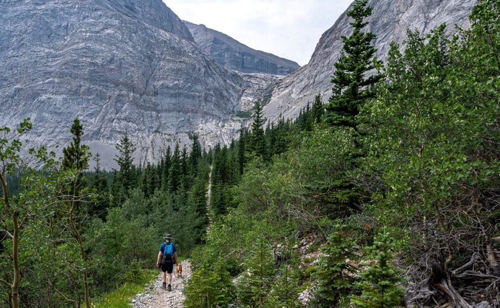 We can finally see the waterfall but we’re not out of the trees for a while yet
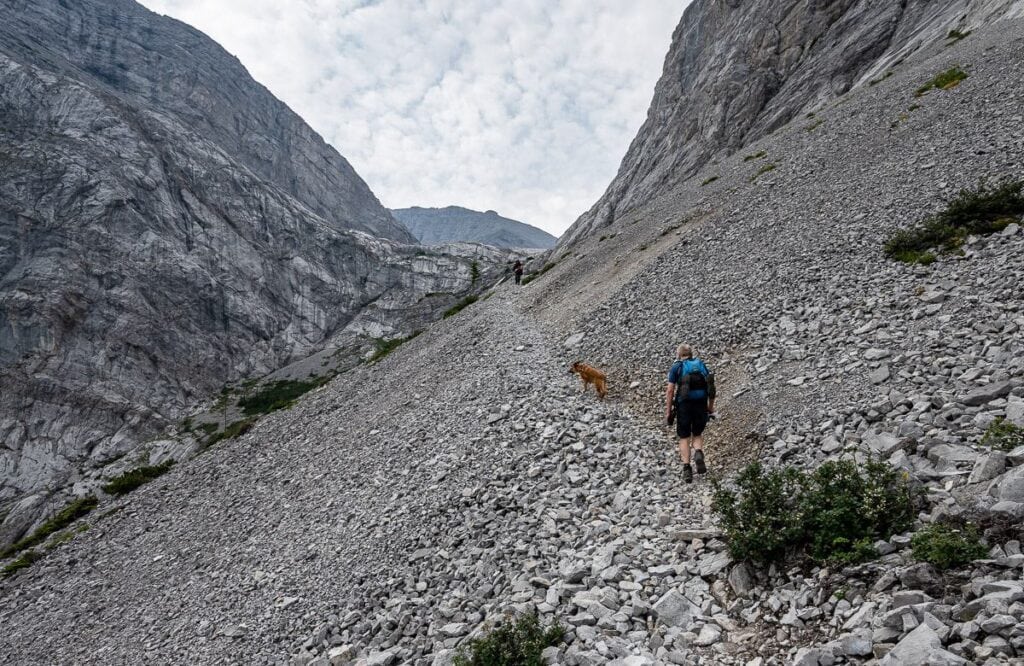 The final section of scree before the chains
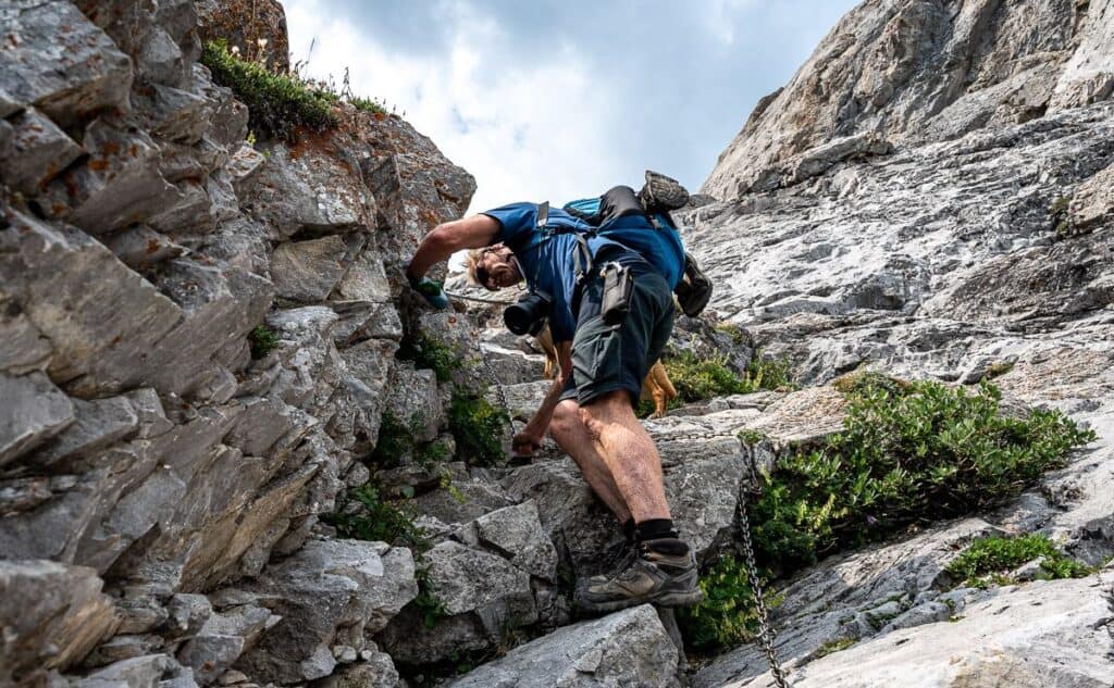 It was tough for John with the dog going up but we worked out a better system on the descent
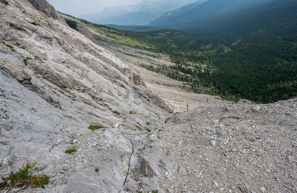 This is where you come out at the top of the chains section
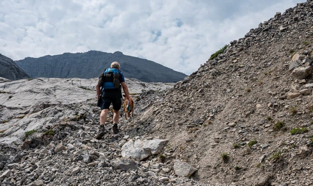 The last 50 m or so to Carnarvon Lake takes but a minute
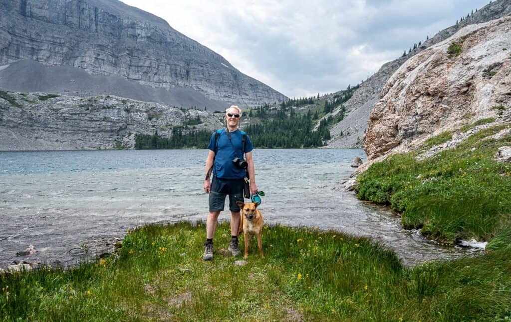 John with Mila at Carnarvon Lake; the camping is in the trees at the end of the lake
 It only takes about 5 minutes to get to the end of Carnarvon Lake
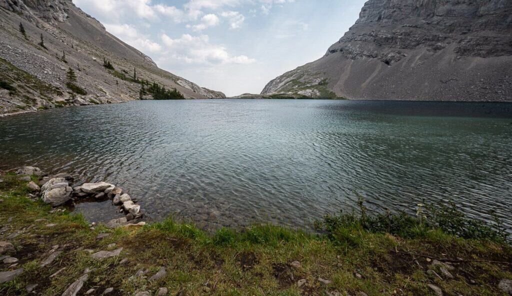 The view of Carnarvon Lake from the campsite – almost looks like an infinity pool
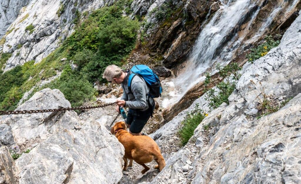 Almost down the last section of chains
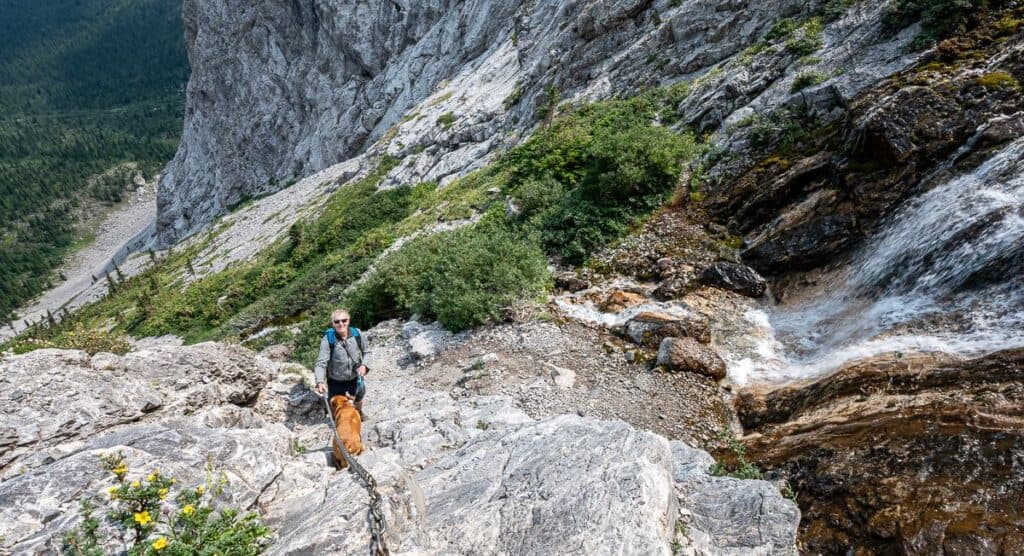 This is the beginning of the chains section and the end of it on the descent
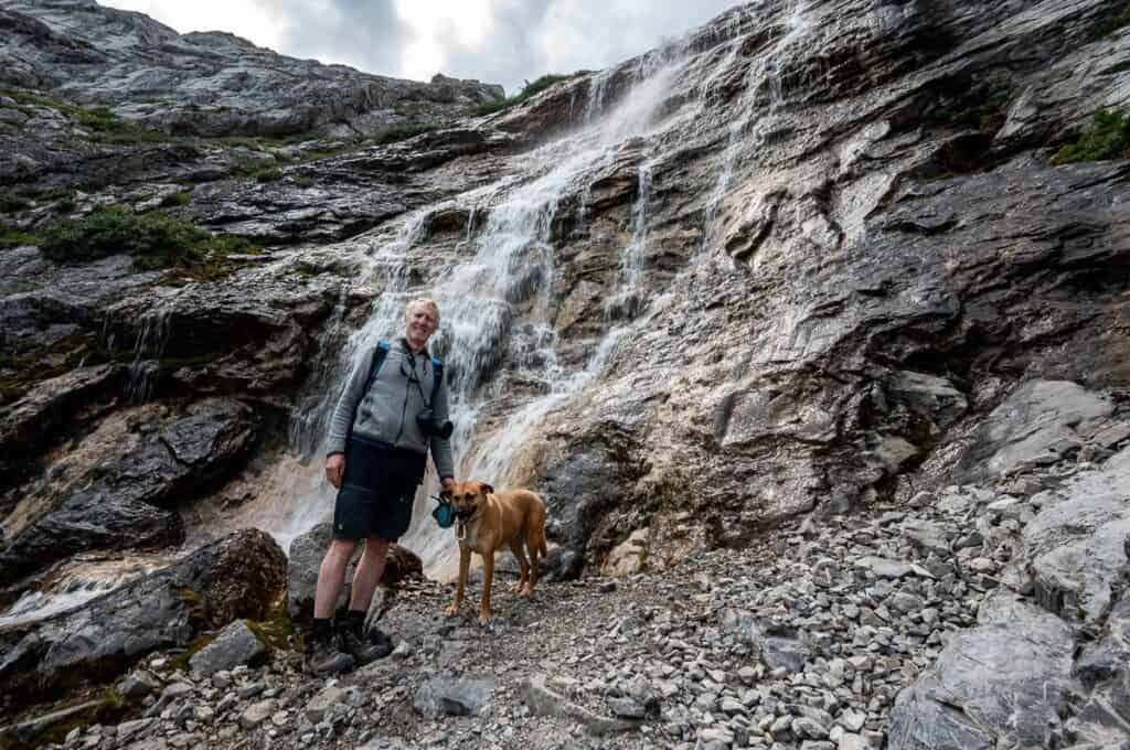 What a beautiful waterfall!
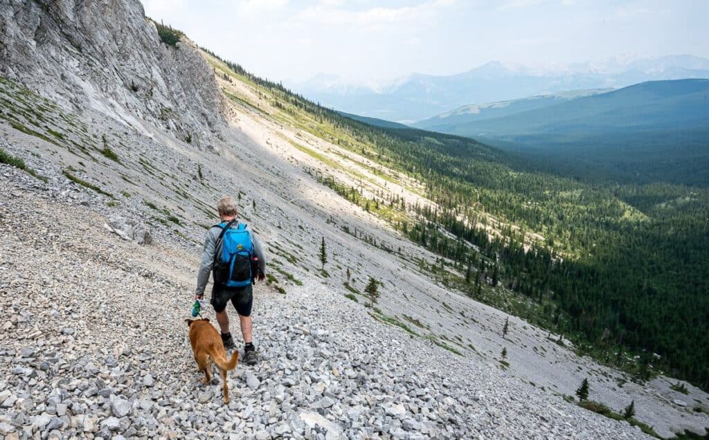 Heading back to the parking lot
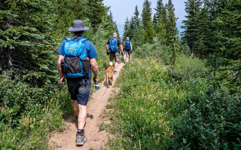 The two guys ahead of us had biked in about 8 km
Camping at Carnarvon Lake
Carnarvon Lake is in a wildland provincial park so random camping is allowed, and no reservations are necessary. However, don’t expect any facilities – no bear lockers, toilets, tent pads, picnic tables etc.
I have read reports where 20 people have been up at Carnarvon Lake at a time – likely on a sunny, summer weekend.
If you decide to spend the night – and most people hiking the trail are doing just that – then PLEASE camp on sites that have been previously used, don’t cut down vegetation, practice Leave No Trace principles, and keep a clean campsite as this is prime bear country. Please bury poop and pack out toilet paper. No one wants to deal with your garbage.
If there is a fire ban, please respect that too.
I’d recommend that you put all your food in either a bear resistant food canister or an Ursack Major Bear Resistant Bag. Hang the bag away from camp.
 Campsites are well worn at Carnarvon Lake
Option for other hikes from Carnarvon Lake
From Carnarvon Lake you have three options, none of which I’ve done. Mount Strachan is the closest and sounds like a doable scramble. You can also climb Mount Muir, and Carnarvon Peak on the way up to Mount MacLaren. All trails can be seen on the Organic Maps app.
Location map of Carnarvon Lake
It’s an unmarked trail to Carnarvon Lake, but route-finding is straightforward.
More hikes off Highway 40
Click on the photo to bookmark to your Pinterest boards.
Please visit:
Our Sponsor