

Post Last Modified – March 20, 2025 ¦ gr8traveltips.com
Certain products/services may have affiliate links where I may receive a commission.
There is no cost to you whatsoever.
Skookumchuck Narrows – Sechelt Rapids
Located in the Province of British Columbia Canada’s beautiful {Sunshine Coast}, you will find the amazing …
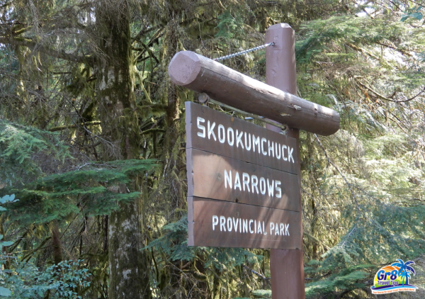
Skookumchuck Narrows Provincial Park
Experience the incredible force of the changing tides in the Skookumchuck Narrows, forming the; Sechelt Rapids.
Skookumchuck refers to – “Strong Water!”
Skookumchuck Narrows Provincial Park – Location

Established back in 1957, this Provincial Park has become the most visited attraction, in all of the beautiful Sunshine Coast.
Located on the west coast of Canada, getting to this part of the Sunshine Coast is easily done via …
BC Ferries.
From the City of Vancouver, you can catch a British Columbia Ferries sailing from; Horseshoe Bay on the mainland, crossing over to the Town of Sechelt, on the Sunshine Coast.
Total driving time from Sechelt, is about 1 hour to the Provincial Park. It is located in the very tiny community of … Egmont.
As you get closer to the {Provincial Park} and Egmont just off the Sunshine Coast Highway, it is well marked, with signs. You will turn onto {Egmont Road} and follow along for 5 kilometers.

Parking is located for Skookumchuck Narrows Provincial Park and just as you are entering, the community of Egmont.
You are also welcome to park across the street at the {Egmont Heritage Centre}.The center is well worth stopping and checking out, during your visit.

The center offers a detailed history of the area and its people. For those traveling from Vancouver Island, you can also catch …
BC Ferries
from the City of Comox, to the City of Powell River {Saltery Bay}. On this route, you then take a 2nd ferry crossing, over to {Earls Cove}. From Earls Cove, you’re just a couple of minutes away from Egmont.

Both crossings are very scenic and make for an excellent {round trip} journey. A great way to see Vancouver Island and the Sunshine Coast, combined.
Hiking to Skookumchuck Narrows

From the parking area, the hike to the best viewing locations of {Sechelt Rapids}, is 4 kilometers in length, one way.

The hike is considered to be {easy to moderate} for the most part. The walk begins along a roadway, with a few private homes alongside. There’s also a very cool looking {seasonal bakery/cafe}, for visitors to check out.

The short roadway then leads onto a broken scenic trail, with a number of your typical; tree roots to walk over, without much difficulty at all.
It’s an 8 kilometer round trip hike, so come prepared with; good walking shoes, water and snacks for the hike, in and out.

As well, do keep in mind that your are in Cougar & Bear Country, as well as other wildlife living in the forest. So take extra care as you normally would, when hiking in the wilderness.

It’s a great hike and the scenery is superb, as you pass along a small lake, heading towards the oceanfront and the Narrows.
Observing The Tides At Skookumchuck Narrows

You definitely want to arrive at the {Sechelt Rapids} in the Skookumchuck Narrows, when the tide changes. This is when the flow of tidal water begins, to switch directions.
Water levels from one end of the rapids to the other, can typically reach; seven feet in height and more!

The tidal current can flow at an incredible; 15 miles per hour or more, as the rapids pump {200 million gallons} of water through Skookumchuck Narrows. This is on a typical tide, of up to 10 feet in height.

Kayaking is very popular for experienced kayakers only, during this change in tides.

The viewpoints at {North Point} and {Roland Point}, are the most popular places to experience, the rapids and kayakers.
It’s an absolutely awesome site to see!
It’s like watching the rapids on a fast flowing river. Definitely, not what you would expect to see in the ocean, as the tides change directions.

The Sunshine Coast is a beautiful part of British Columbia’s west coast. There’s so many small coastal communities to explore, along with outdoor activities galore!
If you are visiting Canada’s west coast, then be sure to include this region, in your travel plans. I’ve included links to the Official Sunshine Coast Tourism website.
I’ve directed the links to their pages on {Egmont and Skookumchuck Narrows}, where both offer much more detailed information on the area. You can also find up to date {Tide Guides}, as well.
Be sure to check out the {Google Map} box at the bottom of this post for its exact location.
Sunshine Coast Tourism – Egmont
Sunshine Coast Tourism – Skookumchuck Narrows
Safe and Healthy Travels!
![]()
All personal photographs on this post are the property of gr8traveltips.com and are copyright protected.
Unauthorized use is strictly prohibited.
Did You Know …
“The annual rainfall on the Sunshine Coast is about 100cm/40in.” Join Me On Instagram For Travel Photos, Video’s & More!

Planning Holidays In British Columbia {Canada}
Don’t Forget It … Be Sure To Pin It!
© 2025, All Rights Reserved ¦ gr8traveltips.com
Please visit:
Our Sponsor