
Would you like to hike in a Swiss Alpine Wonderland? Trick question. The answer is obviously a resounding “Yes!”
Great. We’re here to help.
Nestled in southern Switzerland’s French-speaking Valais region (to the west of Zermatt), the small village of Arolla lies in the Val d’Hérens, while Zinal village is nestled high up in the Val d’Anniviers. The valleys are surrounded by some of the highest peaks in the Alps and offer majestic Alpine panoramas, rugged charm, unspoilt landscapes, and adventurous walking.
Eager to plan your hiking adventure in Switzerland? Let’s get into the details. Happy hiking everyone!
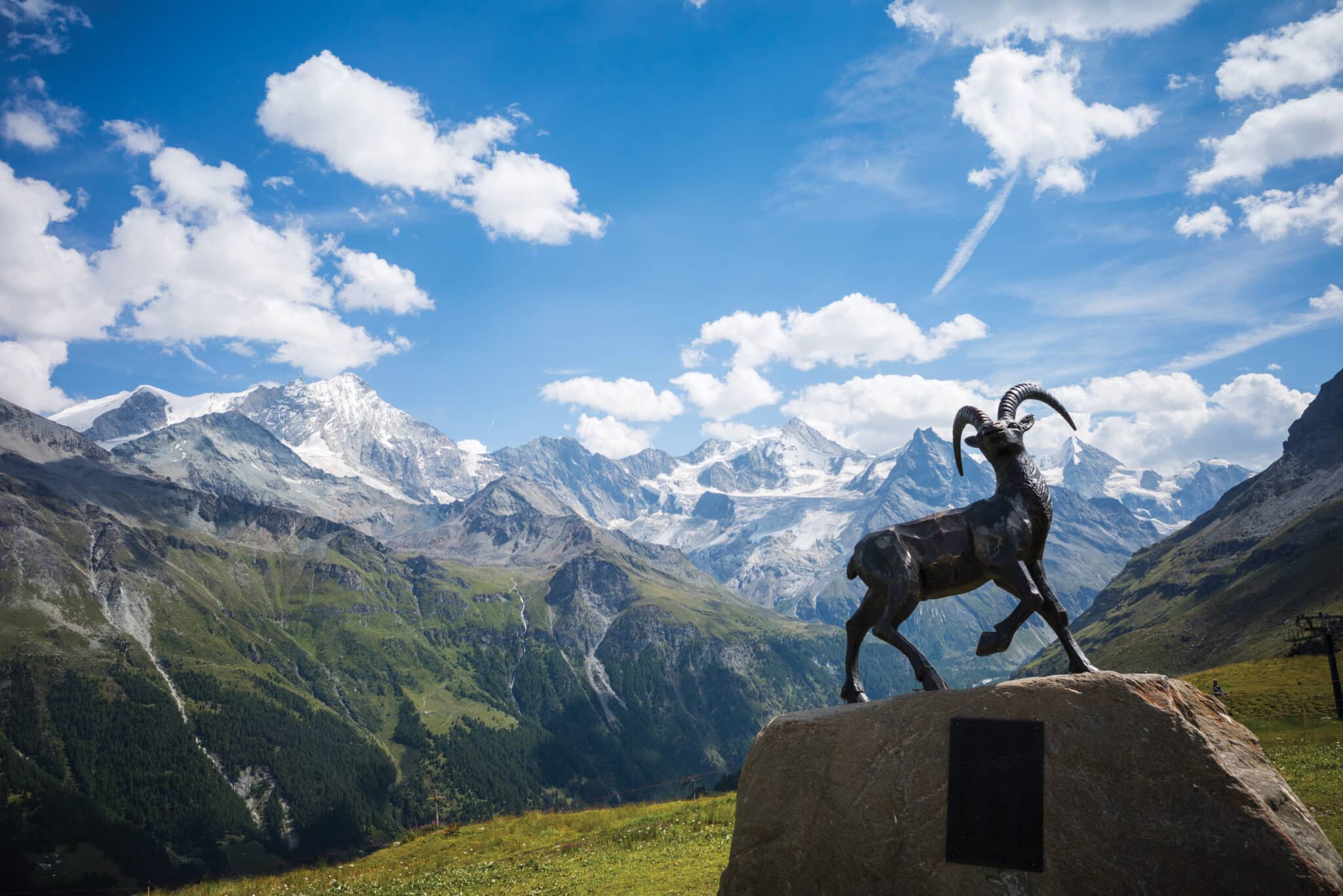
 The Weisshorn and Zinalrothorn (and brass ibex sculpture) from Sorebois © Cicerone Press. From Walking in Arolla and Zinal, 2024, by Jonathan and Lesley Williams.
What are Val d’Hérens and Val d’Anniviers like?
The settlement of these valleys is some of the earliest in the Alps, and many of the early timber-framed houses and barns are lovingly maintained. Farming continues in the villages and surrounding meadows and pastures today, often in much the same way as in times gone by. In summer, sheep, goats and cattle graze the high meadows of the Alps, and in winter, the animals live in farm buildings or are taken to the lower valleys. Festivals that celebrate the beginning and end of summer, when animals are moved to and from high pastures, include cow-fighting contests in spring and autumn as well as other seasonal celebrations.
- The Val d’Hérens is an unspoilt traditional Swiss valley, little impacted by tourism and with only a tiny lift (almost entirely free of skiing infrastructure). The birthplace of the Arolla pine and Hérens cattle, famed throughout the Alps, has a fine, authentic feel. The smaller (but steep and glaciated) mountains have an intimate feel.
- The Val d’Anniviers has more facilities and bigger mountains – the four 4000m peaks of the Dent Blanche, Ober Gabelhorn, Zinalrothorn and Weisshorn dominate the upper valley and provide challenging walks.
- Between the two central valleys, the uninhabited Moiry and Réchy valleys offer much remoter walking.
Both valleys are located near the Italian border and are easily accessible by car and public transport from Switzerland’s airports and stations. There are no trains in either valley, so public transport is by bus. Regular services operate at least hourly, often more frequently, from Sion and Sierre up the valleys. Frequent services also operate between the various villages and walking locations. Services are punctual and reliable, and delays are rare.
The Valais is a French-speaking region, but you may also hear locals speaking in a valley patois when chatting together. English is generally understood and spoken.
 An elegant bridge spans the Navisence torrent, the Weisshorn directly ahead © Cicerone Press.
What’s the walking like?
You might already know the valleys from a Chamonix–Zermatt Haute Route trek, which allows you to explore the region fully.
Much of the walking is middle-grade mountain walking, with a few easier and some more challenging routes. The many ups and downs are rewarded with fantastic mountain views. Swiss hiking signage is excellent, and a hut or mountain inn is usually involved – it’s a place where combining walks into hut-to-hut routes is almost a given.
How do you know if you need to go hiking in Switzerland? Well, if you are:
- A confident mountain walker
- Looking for a hut-to-hut adventure
- Wanting somewhere quieter and cosier than the big centres and resorts
- Wanting a lower cost and friendlier feel
- New to trekking in Switzerland
- Or looking for a beautiful walking tour in the Swiss Alps
…then Arolla and Zinal are for you!
What is the best time of year to go?
The main walking season runs from mid-June to mid-September. September and October can be attractive months to visit, with good daytime temperatures cooling progressively at night and glorious autumn colours. However, mountain huts, accommodation, and restaurants will close during this period.
What accommodation options are available?
A wide range of good accommodation is available throughout the valleys. Helpful tourist offices in the main villages can assist with bookings.
Visitors would typically stay in the traditional villages of Evolène or Les Haudères or the small mountain centre of Arolla at 2000m in the Val d’Hérens. Bases in the Val d’Anniviers are the small resorts of Grimentz and Zinal, which are well-known to skiers.
All these centres have campsites, shops, restaurants, and hotels. It is also possible to walk from hut to hut throughout the region.
 Looking towards the Moiry icefall from the Lac de Châteaupré, near the summer buvette © Cicerone Press.
What are the best day walks in the area?
1. Pas de Chèvres from Arolla
- Start/finish Arolla (2008m)
- Distance 11.5km
- Total ascent 860m
- Time 4hr 30min
The walk to the Pas de Chèvres is a classic of the valley. It is an excellent route with a straightforward path climbing above the hamlet of Arolla to the fine col, with beautiful views. You will also likely see wildlife – chamois and ibex higher up and marmots throughout the climb.
2. Lac Bleu circular walk from Arolla
- Start/finish Arolla village centre (2008m)
- Distance 9.5km
- Total ascent 540m
- Time 3hr 45min
This is a circular walk to one of the best beauty spots in the area. Busy on sunny days, you rarely have Lac Bleu to yourself, but you may find quieter moments by doing a circular walk. The walk up to the lake is mainly through a pine and mixed woodland hillside. The descent to La Gouille follows a wide path through woods, finishing with a riverside path and a suspension bridge before returning to Arolla.
 Roc Vieux with the Dents de Veisivi from Lac Bleu © Cicerone Press.
3. Arolla to Evolène – the high Route 6
- Start/finish Arolla Poste (2008m) / Evolène (1372m)
- Distance 15km
- Total ascent 860m
- Time 5hr 30min
The high-level walking route from Arolla to Evolène is a gem of the region. It takes the so-called ‘chemin difficile’ route to the beautiful Lac Bleu and then makes a traverse through woods before climbing to a high pasture under Mont de l’Etoile. The route then gradually descends towards the valley, passing high farms and the attractive hamlet of L’Ata Gieute before dropping down on a pine-covered path to the charming village of Evolène. This walk follows Swiss Route 6 – the Alpine Passes trail – which crosses southern Switzerland, although signage for Route 6 is minimal between Arolla and Evolène.
4. Bricola and the upper Ferpècle valley
- Start/finish Ferpècle bus stop at Les Salays (1768m)
- Distance 11km
- Total ascent 660m
- Time 4hr 20min
This is the walk to fully appreciate the incredible landscape and skyline of the upper regions of the Ferpècle Valley and for the best views of the mighty Dent Blanche. In high summer, a bus service operates as far as Les Salays (weekends only at other times), but many take a car to park in one of the parking areas a little higher.
Once you’re off the road, a good path leads through woods and open mountainsides. The path is often shared with mountaineers going up to a high hut ready to tackle an ascent of the Dent Blanche, a further 2000m above Bricola.
 Ancient wooden barns and houses in Evolène © Cicerone Press.
5. Pic d’Artsinol
- Start/finish La Meina/Chemeuille at the top of the Lanna ski lift (2122m)
- Distance 11km
- Total ascent 900m
- Time 4hr 30min
Pic d’Artsinol must be one of the finest viewpoints in the western Alps. Standing alone on a ridge above Evolène, it has 360-degree views encompassing Mont Blanc, the Matterhorn and the Jungfrau, and nearer peaks, with the Dent Blanche dominating the eastern side of the Hérens valley. The initial climb is on a track, and the steeper upper section is on good paths with almost no exposure. Make sure you have a good weather day to enjoy the best views.
Are you inspired to hike in Arolla and Zinal?
We sure hope so! All the above information is a good starting point for planning your Swiss hiking adventure. However, if you want a really detailed and massively helpful guidebook, Cicerone Press takes it to the next level.
The Cicerone guidebook to Walking in Arolla and Zinal offers 35-day walks and two multi-day hikes in Switzerland’s Arolla and Zinal regions. Day walks range from 9 to 22 km (6 to 14 miles) and take 2 to 10 hours. They feature well-maintained but often high-altitude paths, with some requiring a good head for heights. The routes are graded for different skill levels. The guidebook also outlines two multi-day hikes: the 5-day Tour of the Val d’Hérens and the 6-day Tour des Cabanes du Val d’Anniviers, both of which combine various day walks. Each walk includes a 1:50,000 map, downloadable GPX files, and detailed information on planning, facilities, and public transport.
It’s hard to ask for a more detailed guide to the region. Check them out!
As always, happy travels folks. We’ll see you on the road.
For over 50 years, Cicerone Press has been your go-to guide for exploring the great outdoors. It is the leading publisher of guidebooks for walkers, trekkers, climbers and cyclists, covering destinations in Britain, Europe, and beyond. You’ll find more inspiring articles and the full range of guidebooks on the Cicerone website.
Just a Pack was not paid to feature this article.
Please visit:
Our Sponsor